Andre771
Active Member
I know this has been done before but thought I'd update and share for those that are starting their grail diary journey.
Once you have the source map image you need to enlarge and cut it into the different pieces that form each of the four Arabia maps found in the diary.
https://www.antiqueprints.com/images/ag5/g5696.jpg This may not be the best resolution to use but it gives you the image that you need to find.
I have created these info graphics to help clarify the sections of the map you need. Each map is colour coded to show where on the main map it is from.
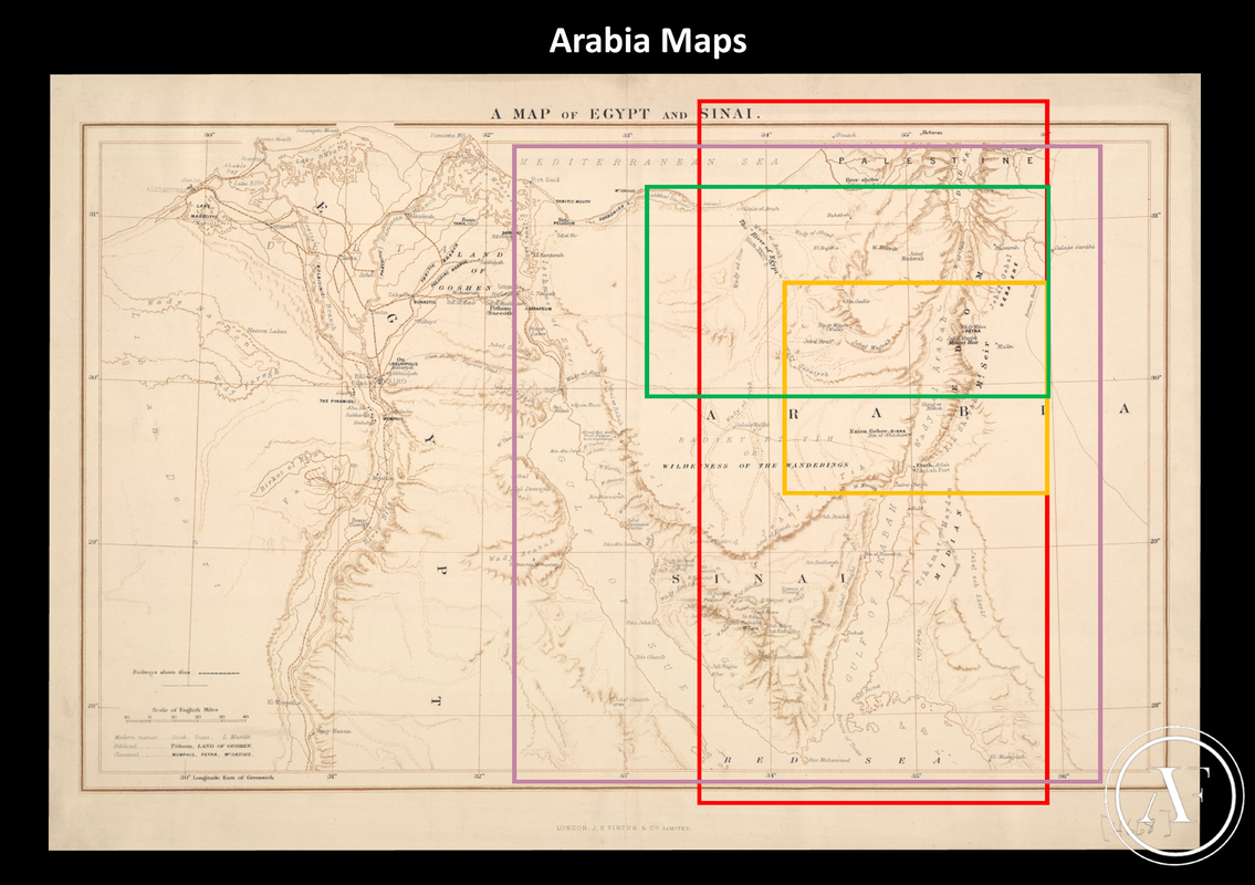
The four maps sourced from the main image are:
Big Dead sea Map - Red Border
Small Arabia Map - Purple border
Two Page Arabia Map - Yellow Border
Long Arabia Map - Green Border
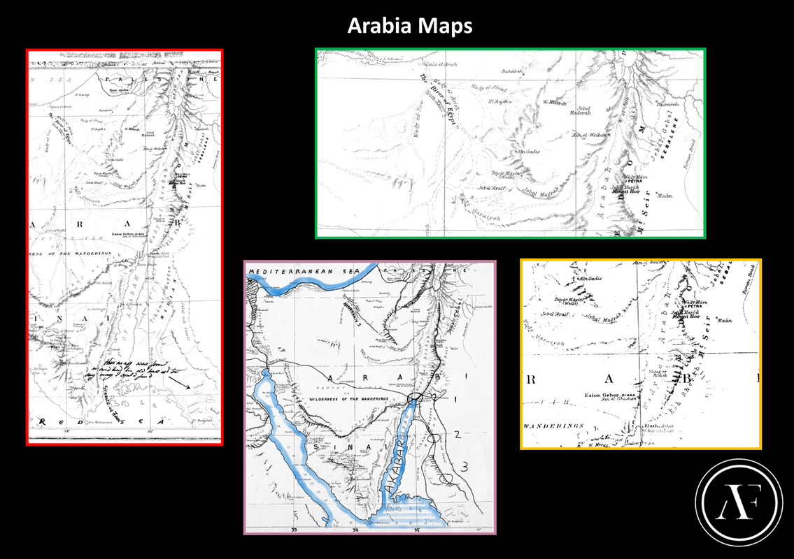
Finished sizes according to my calculations should be about........
Big Dead sea Map - 158mm x 320mm
Small Arabia Map - 158mm x 144mm
Two Page Arabia Map - 158mm x 200mm
Long Arabia Map - 158mm x 325mm
Hope that helps and if you have anything to add or comment then please add to this thread")
Once you have the source map image you need to enlarge and cut it into the different pieces that form each of the four Arabia maps found in the diary.
https://www.antiqueprints.com/images/ag5/g5696.jpg This may not be the best resolution to use but it gives you the image that you need to find.
I have created these info graphics to help clarify the sections of the map you need. Each map is colour coded to show where on the main map it is from.
The four maps sourced from the main image are:
Big Dead sea Map - Red Border
Small Arabia Map - Purple border
Two Page Arabia Map - Yellow Border
Long Arabia Map - Green Border
Finished sizes according to my calculations should be about........
Big Dead sea Map - 158mm x 320mm
Small Arabia Map - 158mm x 144mm
Two Page Arabia Map - 158mm x 200mm
Long Arabia Map - 158mm x 325mm
Hope that helps and if you have anything to add or comment then please add to this thread