Rymo
Sr Member
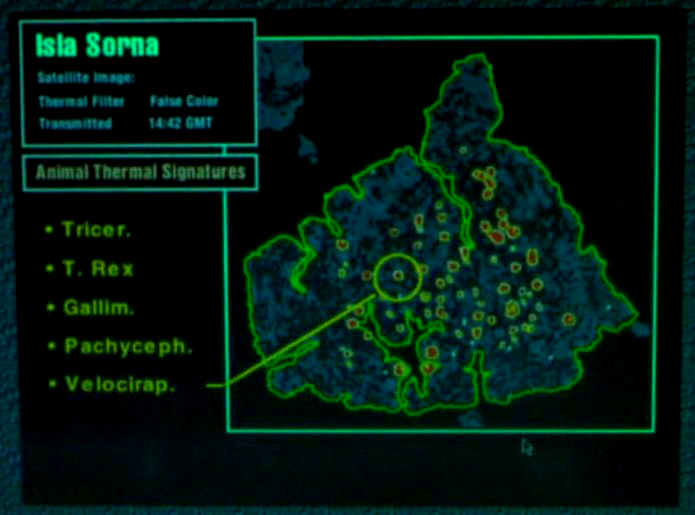
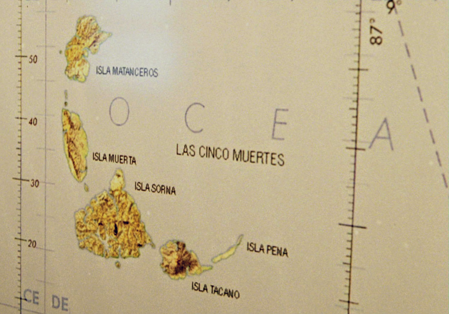
The Kong: Skull Island "Landsat" poster from San Diego Comic-Con inspired me to make a similar poster of the island of Isla Nublar from Jurassic Park. I love the idea of making fake satellite imagery of imaginary places. It seems to add a little bit of reality to the story.
The shape of the island matches the island seen on one of the computer screens in the film. The island details are composited elements taken from actual Landsat imagery of islands around the world. The clouds and ocean are also composited from real satellite images.
It’s still a work in progress. I need to change some of the details in the text portions and clean up the island a bit, but other than that I’m pretty happy with it.
Full print size will be 18”x24”.